Create a Map using ArcGIS.com
Create and Collaborate on Maps and Apps. ArcGIS Online is a cloud-based, collaborative content management system for maps, apps, data, and other geographic information.
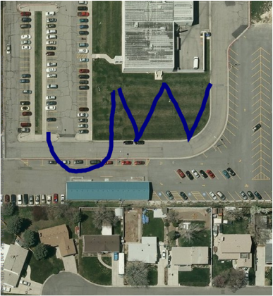
This map was created by using my GPS to create a track by following these steps.
Project Ideas
This map was created by using my GPS to create a track by following these steps.
- I walked a path and recorded a mark every one second. I stopped recording my path after I finished creating the "J," then I started a new path and walked a path to create the "W."
- Once I had walked the paths to create the letters, I uploaded the data to Garmin Basecamp then saved the information as a .GPX file.
- I went to ArcGIS.com and created a new map. I uploaded a new layer using the .GPX file that I saved and the basic data to create this map was set as a layer on my new map.
- OPTIONAL: I edited the color of the path so that it would be easier to see on the map.
Project Ideas
- Have students follow a designated path, or follow a series of points to create a letter or shape.
- Allow students to create their own shapes, then have them draw them by walking the shape using GPS.
- Have groups of students create a collaborative work of art by walking designated or spontaneous paths in a field or parking lot. Allow them to change the colors of their lines to create an art work.

ArcGIS is available as an app from the App Store.